

Moccasin Bend: 12,000 Years of Chattanooga History |
Explore Indigenous heritage, Cherokee removal history, and Civil War connections in a landmark river landscape |
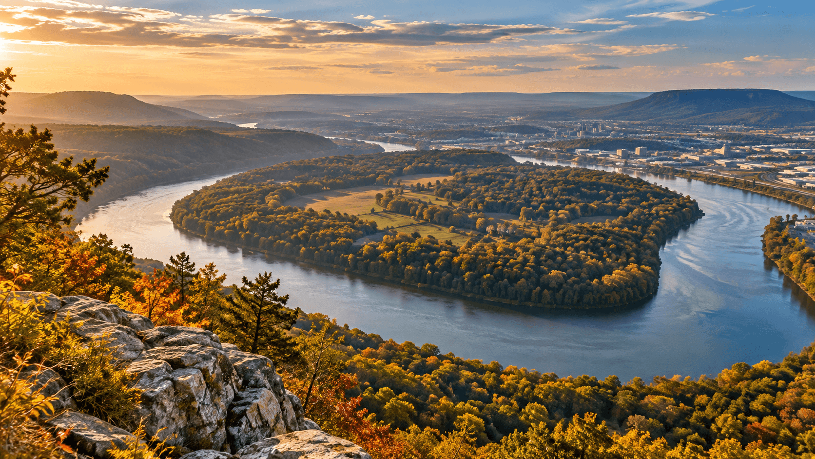
Thousands of people admire the Tennessee River from Lookout Mountain without realizing that the peninsula below preserves evidence of human life stretching back approximately 12,000 years.
Known as Moccasin Bend, this dramatic curve of the river is more than one of Chattanooga's memorable views.
It is a landscape of Indigenous settlement, Cherokee history, Civil War activity, and ongoing efforts to protect irreplaceable archaeological resources.
Moccasin Bend National Archeological District is part of Chickamauga and Chattanooga National Military Park, with public areas where visitors can encounter a small portion of its story.
A place shaped by the river
The river wraps around the peninsula on three sides, helping explain why generations of people found the surrounding land attractive.
Water, fertile soils, woodlands, and access to neighboring valleys supported settlement and movement across the region.
Archaeological research documents Indigenous presence over millennia, including the Archaic, Woodland, and Mississippian periods.
People created communities, cultivated food, developed technologies, and left material traces that still inform archaeological understanding.
Those remains are not simply artifacts of a vanished past; the history of the land is deeply connected to the continuing heritage of Indigenous peoples.
The view from above may seem quiet today, but the ground has long been a place of human activity and meaning.
A Cherokee story that demands remembrance
Moccasin Bend also intersects with the forced removal of Cherokee people from their homelands in 1838 and 1839.
The historic Brown's Ferry Federal Road trace is associated with a Trail of Tears route through this area.
Forced removal uprooted families and brought suffering and loss, a history that should not be reduced to a scenic walking stop.
Remembering these journeys adds essential context to the land and the people whose lives were shaped by it.
For visitors, the historic route offers a reason to approach the site with respect and a willingness to learn.
Chattanooga's Civil War crossroads
Chattanooga's river, railroads, and surrounding heights made it an important strategic location during the Civil War.
In 1863, the area around Moccasin Bend was caught up in military operations during the Chattanooga campaign.
Union artillery positions and supply movements connected this landscape with nearby Lookout Mountain and the wider fighting around the city.
The Cracker Line supply route, opened during the campaign, helped sustain Union forces and involved the Brown's Ferry area.
Today's peaceful view from the surrounding heights offers only a faint hint of the military activity once concentrated here.
That contrast is part of what makes the bend so compelling: the same landscape has carried very different human experiences over time.
Protection for a remarkable district
In 2003, Moccasin Bend National Archeological District was established as part of Chickamauga and Chattanooga National Military Park.
The district protects an unusually long and layered record of occupation and historical events within sight of a growing modern city.
Preservation involves difficult choices because the peninsula has also accommodated modern institutions and infrastructure.
In 2024, Tennessee officials announced they would not proceed with a proposed new psychiatric hospital on state-owned land at Moccasin Bend following archaeological review.
That decision highlighted why thoughtful planning matters in places where disturbing the ground can permanently erase evidence.
Preserving a historic landscape protects knowledge that cannot be recreated once it is lost.
How to experience Moccasin Bend
Visitors should know that Moccasin Bend is not a conventional attraction with extensive tourist facilities.
The National Park Service identifies three public-access areas: Brown's Ferry Federal Road Trace, Blue Blazes Trail, and the Gateway Site.
The road trace gives walkers a place to consider Cherokee removal and Civil War transportation history.
Blue Blazes Trail offers a quieter wooded experience, while the Gateway Site along Hamm Road provides a river-oriented setting.
Not every archaeological or historical site on the peninsula is open to the public.
Visitors should stay on designated routes, leave objects undisturbed, and check current National Park Service guidance before setting out.
Those who want a broad overview of the landform can look across the river from Point Park on Lookout Mountain.
From that vantage point, the winding river makes clear why the location mattered to so many generations.
More than a view
Chattanooga is often introduced through its outdoor attractions, thriving downtown, and mountain scenery.
Moccasin Bend asks residents to look beyond the familiar picture and recognize the far longer history below.
The peninsula's Indigenous heritage, Cherokee removal history, and Civil War connections are distinct stories, each deserving care and accuracy.
Together, they show how a single place can hold many layers of local and national significance.
The next time you see the river sweep around Moccasin Bend, remember that you are looking at more than a beautiful curve of water.
You are looking at a landscape whose stories reach far beyond the lifetime of the modern city. |
0 Comments
Join the conversation
Be the first to comment
Share your thoughts above.